Dong Energy pioneers offshore wind connectivity breakthrough that could have industry-wide benefits
The offshore wind industry would not have been possible before the information age. Enabling live decision making over the vast distances of far offshore wind farms in real time is essential, and the industry’s big challenge.
By Susan Kraemer
Dong Energy expects to be responsible for 1,800 offshore wind turbines by 2020. To keep tabs on such a vast operation, it is pioneering an integration of the Esri and OSIsoft PI System platforms in a shared operational dashboard, so that everyone in its offshore wind division; back office, site office and on-site technicians, can all see and act on the same data in real time and in real space.
Their conventional power plants were already running the OSIsoft PI System, so the company has extended experience with the system, on land-based energy generation.
“And on the electric utility side, Dong Energy had been using Esri for a long time,” says Dave Twichell, Electric and Gas Specialist at Esri the international supplier of Geographic Information System (GIS) software.
“They used our system to manage their spatial data in terms of where the poles and wires and transformers were, and everything they need to run the regular electric grid as well.”
But what is new is combining the two into one live system that is shared and applied throughout the firm’s very extensive offshore wind division.
There is a lot more sophistication in the newer turbines that are being built today, in both their design parameters and in the monitoring of the systems. Scada systems supplied by the OEMs like Siemens and Vestas already make it possible to remotely command each turbine in harsh weather to slow or stop and then restart.
But much more than simply remotely controlling the turbines is made possible by the combining of the two systems, reacting in real time and space, with all the live data visible to all.
Useful real-time information
If the back office needs to get technicians down in harsh weather or if someone is ill, they can see all their options: which way various vessels are going and what their mission is, so that they can select which vessel is closest; or is most appropriate; or the easiest to reroute, that could possibly assist when there is a change of plans.
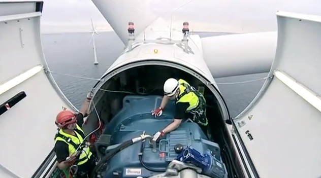
If a technician encounters a problem that needs some specific assistance with a particular issue on a turbine, they can immediately get a visual overview of the situation.
“What they see on the map is the location of the technicians on the vessel, and if a technician is en route or is arriving. They see exactly when they pull up to the turbine,” says Twichell.
“So they could find the nearest vessel that has the technician that is equipped to solve this exact problem and then determine the quickest way to route them over the undersea cables that are connecting the turbines, so it's important that they also know where those are, so they can route the boats so that they don't interrupt the cables or hit them.”
Previously, jack up footprints were just a series of overlays of ‘dead files’ marking the spots to avoid, such as cables or even undetonated bombs left over from WWII. But when everything is live in the same system, using Esri with the Geo footprint, then the risk of human error is reduced. As explained to Wind Energy Update, it is much easier, because there is no chance of overlaying the maps inaccurately.
A fault on a cable is also more easily located.
It is one thing to have a work order directing you to a particular blade or a gearbox with an issue, but if the fault appears to be in a cable that is maybe 100 km long, then suddenly the data needs to be represented in geographic space to locate the flaw.
“Pretty hard to comprehend if you don't have graphical systems actually supporting you, and getting that overview, and also giving you a visceral overview,” explains Kristian Sorgenfri, Director of Wind Power, Operations at Dong Energy.
Enhancing machine intelligence
“Offshore wind is an industry that is driven by data. You have a lot of new technology coming out,” he points out. “Just a couple of years ago the biggest machine was a 3.6 megawatt; and now we're talking about 8 megawatt machines. New products are coming out all the time and we don't really have time to gain the experience that we need, to make use of all the data that we get out of the equipment.”
He credits the combined platform - of the PI Integrator for Esri ArcGIS with OSIsoft - with enabling workers to take in new technology, because they have all the tools in place to put their learning into a system from the very beginning.
“In a mature business where you have products that have a known lifetime span in terms of maturation, there you will gain some kind of experience that you could just apply year after year,” he explains. “To master all that right away; we need a lot of data points to support us, because there are so many different aspects; the human mind cannot grasp it all.”
The wind technicians, site office and back office all have access to shared real-time data displays that includes geographic locations of stationary assets like turbines and cables but also all the mobile assets like vessels and each technician with specific skills - using the real space viewer from Esri ArcGIS.
So the integration of the two systems makes real collaboration possible. The combination also speeds up the learning curve for the new industry, not just human learning but also machine learning.
Conserving human brain power to solve new problems
“We can put in all the failure modes we know into the system, and so our brain trust is only used on the failure modes that we don’t know,” Sorgenfri explains.
“Whereas if you don't have a system like this, then you would have to do diagnostics and prognostics also on the things that you actually did know.”
If engineers see patterns of vibration or of temperature variation that are not within the expected range, they can put those learnings into the system and so next time it occurs it can alert the technician, who can foresee the effect, based on that history.
Sorgenfri believes that this learning could be even faster if it included problems and solutions commonly encountered throughout the entire offshore industry.
“What we want to do is to expand the scope of what we can do, and actually invite other players,” he suggests. “Because then you can leverage much more than you would be able to if you were doing everything in-house.”